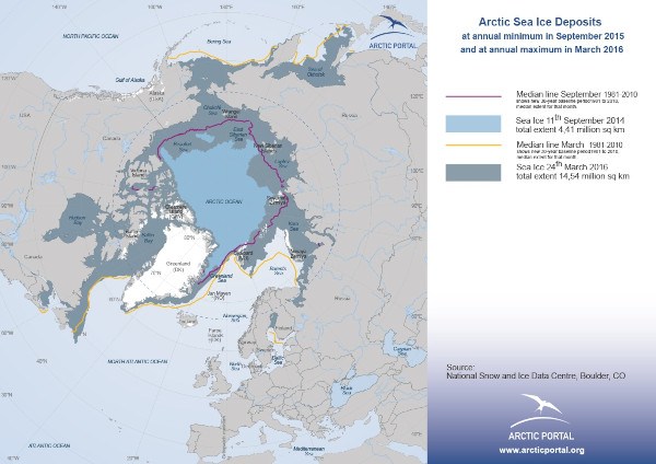
This map shows the sea-ice extent both at its summer lowest, September 2015 and winter highest, March 2016, and the median line for March and September 1981-2010.
Additional maps are available for the period from 1979 to 2015; please contact
© Arctic Portal 2006-2025
Last updated: April 2016
Source
NSIDC
{hide accesslevels="Guest"}Download{/hide}
{show accesslevels="Guest"}
{/show}